NOTE TO READERS: In keeping with our philosophy of lifelong learning, we are now on Twitter as @cachemaniacs. If you’re interested, there’s a Twitter follow button over on the sidebar or you can just click the link above. You can also E-mail us.
Hi again,
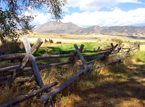
One of the great things about geocaching and its kin is that it gets you out into places that you would never go to otherwise. We often come across great scenery in our travels. Particularly out west, there’s a Kodak moment around every bend. Every once in a while though, we happen upon a vista which is there and gone in a moment. Clouds, sky, animals, fall colors, mountains, mist, shadows, snow and sunlight often combine to offer a breathtaking view which is gone in a matter of seconds. Our camera has caught a number of them. This is one of our favorites.
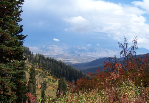
This is the Teton Pass overlooking Jackson Hole, WY in mid-September. Altitude 8,631 feet. We were up here making our way along the spine of the ridge and looking for geocaches (of course). For the most part, it was a dreary day, cold and windy. As we returned to the trail head, the clouds parted and out came the sun. The fall colors exploded and the far mountains came into view. We have gone to places a number of times to catch the leaves at their peak and always seem to be a bit early or too late. On this day, we blundered right into the height of the fall colors. Ten minutes later, we were chased down the mountain by snow flurries and an abundance of caution. The restrictive photo size in the blog doesn’t do justice to the view. Click this link for a full sized version.
Just off to the left of the photo is Highway 22. Called the Teton Pass Highway, it runs from Jackson Hole to Victor, ID through the Caribou-Targhee National Forest. The road is steep and winding. Unlike most American mountain ranges, the Tetons do not have foothills or some sort of transition region. They jut straight up from the flat lands of the Snake River Valley.
Every July, Hungry Jack’s General Store in Wilson, WY sponsors the Teton Pass Hill Climb from the store to the pass. Each rider throws in 20 bucks and winner takes all. Although only 5 1/2 miles long, it gains a half mile in elevation with an average grade of 6.7% and a max of 14%. We’ll stick to Rails-to-Trails.
The photo was taken near coordinates N43.4973° W110.956°. Click on the coordinates for an interactive Google Map.
Cheers …. Boris and Natasha